File:Eastern Equatoria Map.svg

Size of this PNG preview of this SVG file: Amachashazikazi ama-800 adlulayo nama-581 amile. Other resolutions: Amachashazikazi ama-320 adlulayo nama-232 amile | Amachashazikazi ama-640 adlulayo nama-465 amile | Amachashazikazi ama-1,024 adlulayo nama-743 amile | Amachashazikazi ama-1,280 adlulayo nama-929 amile | Amachashazikazi ama-2,560 adlulayo nama-1,858 amile | Amachashazikazi ama-1,561 adlulayo nama-1,133 amile.
Ifayela ewu ngqo (SVG file, nominally 1,561 × 1,133 pixels, file size: 208 KB)
Isifinyezo
| Incazelo |
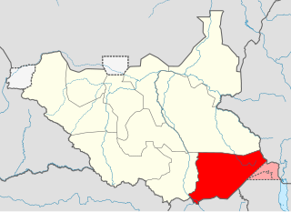
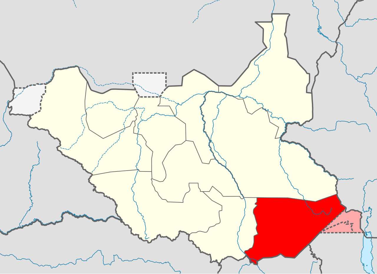
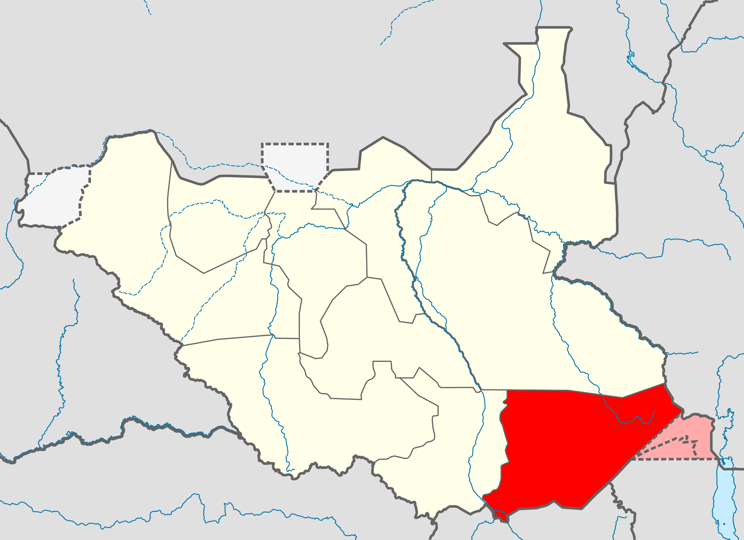
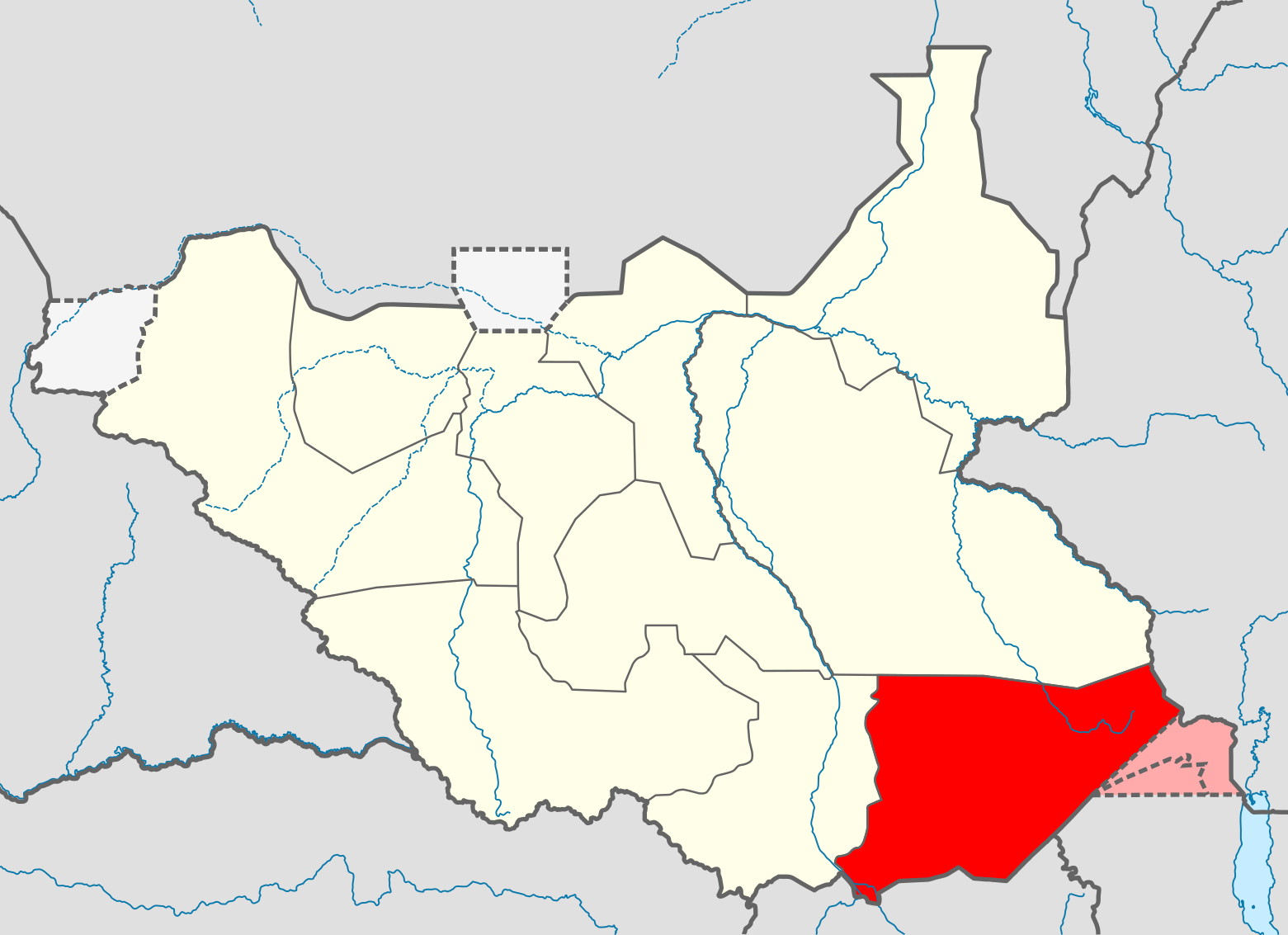
English: Locator map of Eastern Equatoria state — in South Sudan.
Српски / srpski: Мапа Источне Екваторије
Español: Mapa de Ecuatoria Oriental, Sudan Sur.
|
||||||
| Usuku | |||||||
| Umthombo | Own work | ||||||
| Umlobi | Ivan25 | ||||||
| Other versions | Derivative works of this file: Equatoria Region.svg | ||||||
Licensing
I, the copyright holder of this work, hereby publish it under the following license:
This file is licensed under the Creative Commons Attribution-Share Alike 3.0 Unported license.
- Ukhululekile:
- ukwabelana – to copy, distribute and transmit the work
- to remix – to adapt the work
- Ngaphansi kwezimo ezilandelayo:
- attribution – You must give appropriate credit, provide a link to the license, and indicate if changes were made. You may do so in any reasonable manner, but not in any way that suggests the licensor endorses you or your use.
- yabelana ngokufana – If you remix, transform, or build upon the material, you must distribute your contributions under the same or compatible license as the original.
Umlando womqulu
Click on a date/time to view the file as it appeared at that time.
| Usuku/Isikhathi | Isithonjana | Dimensions | Umsebenzisi | Amazwana | |
|---|---|---|---|---|---|
| Njengamanje | 07:27, 19 uNcwaba 2011 | | 1,561 × 1,133 (208 KB) | Spesh531 | update in boundaries |
| 07:27, 19 uNcwaba 2011 |  | 1,561 × 1,133 (208 KB) | Spesh531 | update in boundaries | |
| 17:36, 15 uNtulikazi 2011 |  | 1,500 × 1,133 (245 KB) | Nicolay Sidorov | +/- Ilemi triangle | |
| 04:11, 9 uNtulikazi 2011 |  | 1,500 × 1,133 (244 KB) | B1mbo | New version based in File:South Sudan location map.svg | |
| 13:55, 16 uNhlangulana 2011 |  | 422 × 315 (20 KB) | Ivan25 |
Ukusetshenziswa komqulu
The following page uses this file:
Ukusetshenziswa komqulu jikelele
Amanye ama-wiki asebenzisa lefayela
- Ukusetshenziswa ku-ab.wikipedia.org
- Ukusetshenziswa ku-ar.wikipedia.org
- Ukusetshenziswa ku-bg.wikipedia.org
- Ukusetshenziswa ku-ca.wikipedia.org
- Ukusetshenziswa ku-el.wikipedia.org
- Ukusetshenziswa ku-en.wikipedia.org
- Eastern Equatoria
- Torit
- Lango people (South Sudan)
- Didinga people
- Madi people
- Kidepo River
- Kinyeti
- Toposa people
- Otuho people
- Tennet people
- Pari people
- Magwi County
- Nimule
- Kapoeta Airport
- Nimule Airport
- Torit Airport
- Kapoeta
- Boya people
- Lopit people
- Imatong Mountains
- Torit County
- Koss River
- Ikotos County
- Ikotos
- Demographics of South Sudan
- Magwi
- Kangen River
- Lotilla River
- Lafon, South Sudan
- Lafon County
- Chukudum
- Budi County
- Kapoeta South County
- Template:Eastern Equatoria
- Narus, South Sudan
- Didinga Hills
- Narus River, Kapoeta
- Veveno River
- Medikiret River
- Bandingilo National Park
- Kapoeta East County
- Kapoeta North County
- Kinyeti River
- Acholi people
- Ukusetshenziswa ku-eo.wikipedia.org
View more global usage of this file.