File:Katete town district location.PNG

Size of this preview: Amachashazikazi ama-800 adlulayo nama-550 amile. Other resolutions: Amachashazikazi ama-320 adlulayo nama-220 amile | Amachashazikazi ama-640 adlulayo nama-440 amile | Amachashazikazi ama-912 adlulayo nama-627 amile.
Ifayela ewu ngqo (912 × 627 pixels, file size: 102 KB, MIME type: image/png)
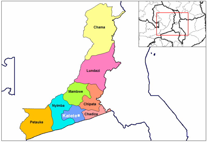
Isifinyezo
| Incazelo | Katete town & district location map |
| Usuku | |
| Umthombo | This is Image:Eastern Zambia districts.png by User:Rarelibra (public domain) with town location added |
| Umlobi | Town location added by MyName (Rexparry sydney) |
| Other versions | Similar to on Image:Eastern Zambia districts.png |
Licensing
| I, the copyright holder of this work, release this work into the public domain. This applies worldwide. In some countries this may not be legally possible; if so: I grant anyone the right to use this work for any purpose, without any conditions, unless such conditions are required by law. |
Umlando womqulu
Click on a date/time to view the file as it appeared at that time.
| Usuku/Isikhathi | Isithonjana | Dimensions | Umsebenzisi | Amazwana | |
|---|---|---|---|---|---|
| Njengamanje | 13:50, 21 uMbasa 2007 | | 912 × 627 (102 KB) | Rexparry sydney~commonswiki | == Summary == {{Information |Description=Katete town & district location map |Source=self-made from Image:Eastern Zambia districts.png (public domain) |Date=20-4-07 |Author= MyName (Rexparry sydney) |other_versions=Based on Image |
Ukusetshenziswa komqulu
The following page uses this file:
Ukusetshenziswa komqulu jikelele
Amanye ama-wiki asebenzisa lefayela
- Ukusetshenziswa ku-en.wikipedia.org
- Ukusetshenziswa ku-nl.wikipedia.org
- Ukusetshenziswa ku-pt.wikipedia.org
- Ukusetshenziswa ku-zh.wikipedia.org