File:Matabeleland North districts.png
Ifayela ewu ngqo (1,056 × 816 pixels, file size: 33 KB, MIME type: image/png)
Isifinyezo
| Incazelo |
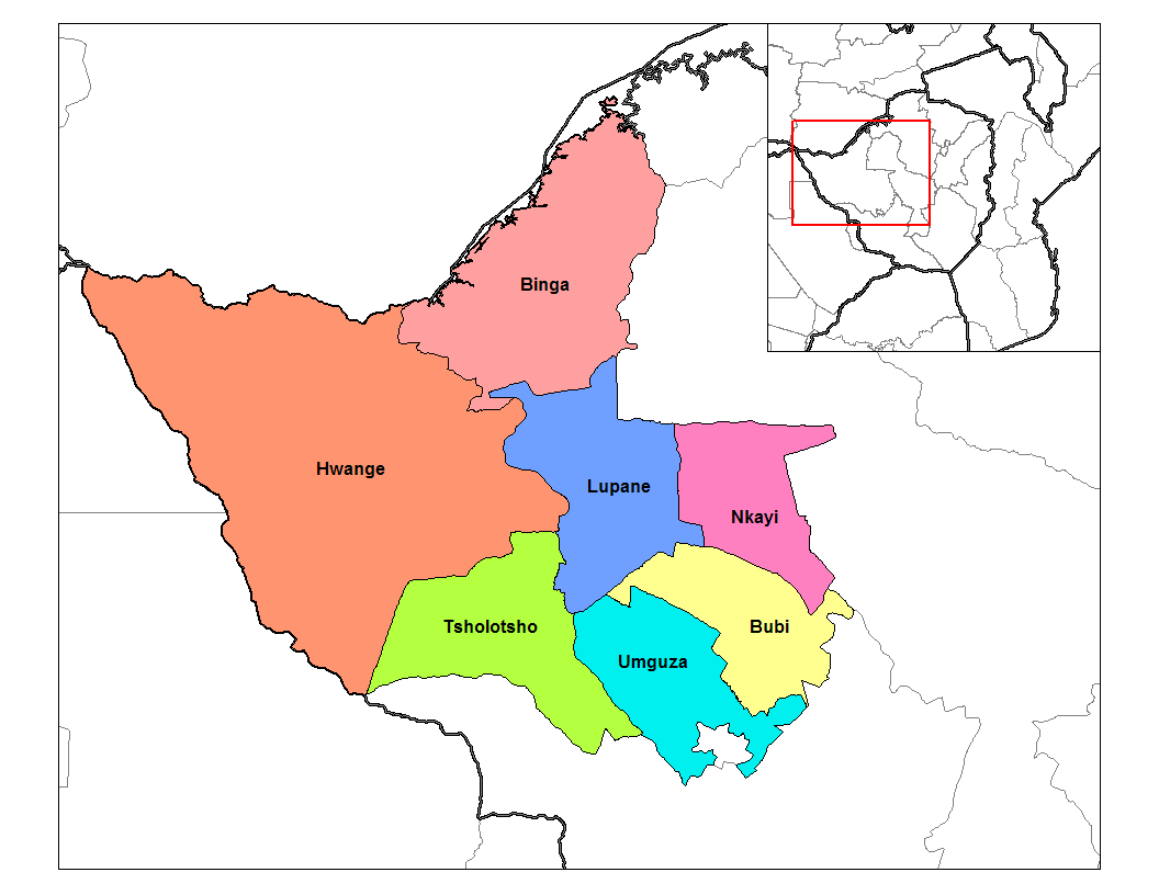
English: Map of the districts of Matabeleland North province of Zimbabwe. |
| Usuku | 28 uMandulo 2006 (original upload date) |
| Umthombo |
Own work (Rarelibra) using MapInfo Professional v8.5 and various mapping resources Transferred from en.wikipedia |
| Umlobi | Rarelibra at en.wikipedia |
Licensing
| This work has been released into the public domain by its author, Rarelibra at i-English Wikipedia. This applies worldwide. In some countries this may not be legally possible; if so: Rarelibra grants anyone the right to use this work for any purpose, without any conditions, unless such conditions are required by law. |
Original upload log
The original description page was here. All following user names refer to en.wikipedia.
- 2006-09-28 18:33 Rarelibra 1056×816× (33578 bytes) Map of the districts of Matabeleland North province of Zimbabwe. Created by ~~~~ for public domain use, using MapInfo Professional v8.5 and various mapping resources.
Umlando womqulu
Click on a date/time to view the file as it appeared at that time.
| Usuku/Isikhathi | Isithonjana | Dimensions | Umsebenzisi | Amazwana | |
|---|---|---|---|---|---|
| Njengamanje | 19:00, 10 uMasingana 2011 | | 1,056 × 816 (33 KB) | Klik9 | {{Information |Description={{en|Map of the districts of Matabeleland North province of Zimbabwe. Created by Rarelibra |Source=Transferred from [http://en.wikipedia.org en.wikipedia] |Date=2006 |Author=Original uploader was [[:en:Us |
Ukusetshenziswa komqulu
The following 9 pages use this file:
Ukusetshenziswa komqulu jikelele
Amanye ama-wiki asebenzisa lefayela
- Ukusetshenziswa ku-ca.wikipedia.org
- Ukusetshenziswa ku-de.wikipedia.org
- Ukusetshenziswa ku-en.wikipedia.org
- Ukusetshenziswa ku-es.wikipedia.org
- Ukusetshenziswa ku-frr.wikipedia.org
- Ukusetshenziswa ku-fr.wikipedia.org
- Ukusetshenziswa ku-ha.wikipedia.org
- Ukusetshenziswa ku-ig.wikipedia.org
- Ukusetshenziswa ku-it.wikipedia.org
- Ukusetshenziswa ku-ja.wikipedia.org
- Ukusetshenziswa ku-ka.wikipedia.org
- Ukusetshenziswa ku-lt.wikipedia.org
- Ukusetshenziswa ku-mrj.wikipedia.org
- Ukusetshenziswa ku-nl.wikipedia.org
- Ukusetshenziswa ku-pl.wikipedia.org
- Ukusetshenziswa ku-pt.wikipedia.org
- Ukusetshenziswa ku-ru.wikipedia.org
- Ukusetshenziswa ku-sn.wikipedia.org
- Ukusetshenziswa ku-tr.wikipedia.org
- Ukusetshenziswa ku-ts.wikipedia.org
- Ukusetshenziswa ku-uk.wikipedia.org
- Ukusetshenziswa ku-vi.wikipedia.org
- Ukusetshenziswa ku-www.wikidata.org
- Ukusetshenziswa ku-yo.wikipedia.org