File:Northbound entering Gorongosa District.JPG

Size of this preview: Amachashazikazi ama-800 adlulayo nama-462 amile. Other resolutions: Amachashazikazi ama-320 adlulayo nama-185 amile | Amachashazikazi ama-640 adlulayo nama-369 amile | Amachashazikazi ama-1,031 adlulayo nama-595 amile.
Ifayela ewu ngqo (1,031 × 595 pixels, file size: 123 KB, MIME type: image/jpeg)
Isifinyezo
| Incazelo |
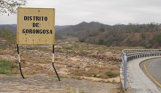
English: Travelling north on the main north-south highway of Mozambique (the EN1), entering the Gorongosa District. The bridge over the Rio Púnguè continues to the right of the photo. Note that river's low water level is typical of the late dry season. |
||
| Usuku | |||
| Umthombo | Own work | ||
| Umlobi | Brian Dell | ||
| Permission (Reusing this file) |
|
| Camera location | | View this and other nearby images on: OpenStreetMap |
|---|
Umlando womqulu
Click on a date/time to view the file as it appeared at that time.
| Usuku/Isikhathi | Isithonjana | Dimensions | Umsebenzisi | Amazwana | |
|---|---|---|---|---|---|
| Njengamanje | 08:07, 11 uLwezi 2008 | | 1,031 × 595 (123 KB) | Bdell555 | {{Information |Description={{en|1=Travelling north on the main north-south highway of Mozambique, entering the Gorongosa District. The bridge continues to the right of the photo. Note that the river's low water level is typical of the late dry season.}} |
Ukusetshenziswa komqulu
The following page uses this file:
Ukusetshenziswa komqulu jikelele
Amanye ama-wiki asebenzisa lefayela
- Ukusetshenziswa ku-ca.wikipedia.org
- Ukusetshenziswa ku-ceb.wikipedia.org
- Ukusetshenziswa ku-en.wikipedia.org
- Ukusetshenziswa ku-fi.wikipedia.org
- Ukusetshenziswa ku-ha.wikipedia.org
- Ukusetshenziswa ku-ig.wikipedia.org
- Ukusetshenziswa ku-no.wikipedia.org
- Ukusetshenziswa ku-pt.wikipedia.org
- Ukusetshenziswa ku-ts.wikipedia.org
- Ukusetshenziswa ku-www.wikidata.org
- Ukusetshenziswa ku-yo.wikipedia.org
- Ukusetshenziswa ku-zh-min-nan.wikipedia.org
- Ukusetshenziswa ku-zh.wikipedia.org