File:Uganda location map.svg

Ifayela ewu ngqo (SVG file, nominally 1,441 × 1,466 pixels, file size: 431 KB)
Isifinyezo
| Incazelo |
Deutsch: Positionskarte von Uganda
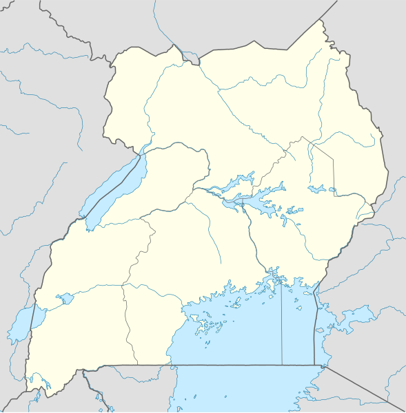
Quadratische Plattkarte. Geographische Begrenzung der Karte:
English: Location map of Uganda
Equirectangular projection. Geographic limits of the map:
|
|
| Usuku | ||
| Umthombo |
Own work, using
|
|
| Umlobi | NordNordWest | |
| Permission (Reusing this file) |
This file is licensed under the Creative Commons Attribution-Share Alike 3.0 Germany license.
 This file is licensed under the Creative Commons Attribution-Share Alike 3.0 Germany license.
|
|
| Other versions |
Derivative works of this file: Uganda location map Topographic.png |


|
This map has been made or improved in the German Kartenwerkstatt (Map Lab). You can propose maps to improve as well.
|
Umlando womqulu
Click on a date/time to view the file as it appeared at that time.
| Usuku/Isikhathi | Isithonjana | Dimensions | Umsebenzisi | Amazwana | |
|---|---|---|---|---|---|
| Njengamanje | 19:25, 1 uZibandlela 2009 | | 1,441 × 1,466 (431 KB) | NordNordWest | =={{int:filedesc}}== {{Information |Description= {{de|Positionskarte von Uganda}} Quadratische Plattkarte. Geographische Begrenzung der Karte: * N: 4.5° N * S: 1.7° S * W: 29.2° O * O: 35.3° O {{en|Location map of Uganda} |
Ukusetshenziswa komqulu
More than 100 pages use this file. The following list shows the first 100 pages that use this file only. A full list is available.
- Abim, Yuganda
- Adjumani
- Alebtong
- Amolatar
- Amuria
- Amuru, Yuganda
- Apac
- Arua
- Bombo, Yuganda
- Budaka, Idolobha
- Bugembe
- Bugiri
- Buikwe
- Bukedea
- Bukomansimbi
- Bukungu
- Buliisa
- Bundibugyo
- Busembatya, Yuganda
- Bushenyi
- Busia, Yuganda
- Busolwe
- Butaleja
- Buwenge
- Buyende
- Dokolo
- Elegu
- Entebbe
- Fort Portal
- Gombe, Butambala
- Gulu
- Hima, Yuganda
- Hoima
- Ibanda, Yuganda
- Iganga
- Isingiro
- Jinja, Yuganda
- Kaabong
- Kabale
- Kaberamaido
- Kagadi
- Kakira
- Kakiri
- Kalangala
- Kaliro
- Kalisizo
- Kalongo
- Kalungu, Yuganda
- Kampala
- Kamuli
- Kamwenge
- Kanoni
- Kanungu
- Kapchorwa
- Karenga District
- Kasese
- Katakwi
- Kayunga
- Kibaale
- Kibingo, Yuganda
- Kiboga
- Kihihi
- Kira, Idolobha
- Kiruhura, Yuganda
- Kiryandongo
- Kisoro
- Kitgum, Yuganda
- Koboko
- Kotido
- Kumi, Idolobha
- Kyazanga
- Kyegegwa
- Kyenjojo
- Kyotera
- Lira, Yuganda
- Lugazi
- Lukaya, Yuganda
- Luweero
- Lwakhakha, Yuganda
- Lwengo
- Lyantonde
- Malaba, Yuganda
- Manafwa
- Masaka
- Masindi
- Masindi Port
- Masulita
- Matugga
- Mbale, Yuganda
- Mbarara
- Mityana
- Moroto, Idolobha
- Mubende
- Mukono, Idolobha
- Nakasongola
- Njeru
- Sheema
- Soroti
- Ssabagabo
- Wakiso, Idolobha
View more links to this file.
Ukusetshenziswa komqulu jikelele
Amanye ama-wiki asebenzisa lefayela
- Ukusetshenziswa ku-af.wikipedia.org
- Ukusetshenziswa ku-am.wikipedia.org
- Ukusetshenziswa ku-an.wikipedia.org
- Ukusetshenziswa ku-ar.wikipedia.org
- Ukusetshenziswa ku-ast.wikipedia.org
- Ukusetshenziswa ku-av.wikipedia.org
- Ukusetshenziswa ku-azb.wikipedia.org
- Ukusetshenziswa ku-az.wikipedia.org
- Ukusetshenziswa ku-be-tarask.wikipedia.org
- Ukusetshenziswa ku-be.wikipedia.org
View more global usage of this file.