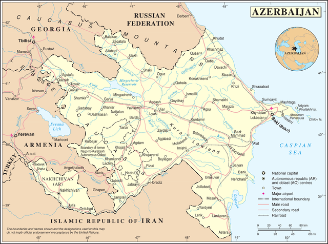
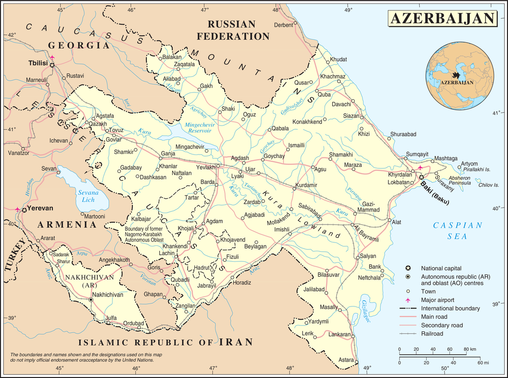
File:Un-azerbaijan.png

Ifayela ewu ngqo (3,037 × 2,257 pixels, file size: 1.56 MB, MIME type: image/png)
| This image is a map derived from a United Nations map.
Unless stated otherwise, UN maps are to be considered in the public domain. This applies worldwide. UN maps are, in principle, open source material and you can use them in your work or for making your own map. UN requests however that you delete the UN name, logo and reference number upon any modification to the map. Content of your map will be your responsibility. You can state in your publication, if you wish, something like: based on UN map … (map name, map number, revision number and date). See: Geospatial Information Section. And: Geospatial, location data for a better world. |
 |
Umlando womqulu
Click on a date/time to view the file as it appeared at that time.
| Usuku/Isikhathi | Isithonjana | Dimensions | Umsebenzisi | Amazwana | |
|---|---|---|---|---|---|
| Njengamanje | 02:50, 23 uMfumfu 2007 | | 3,037 × 2,257 (1.56 MB) | Jeroen | {{UN map}} Category:Maps of Azerbaijan |
Ukusetshenziswa komqulu
The following page uses this file:
Ukusetshenziswa komqulu jikelele
Amanye ama-wiki asebenzisa lefayela
- Ukusetshenziswa ku-bn.wikipedia.org
- Ukusetshenziswa ku-ce.wikipedia.org
- Ukusetshenziswa ku-da.wikipedia.org
- Ukusetshenziswa ku-de.wikipedia.org
- Ukusetshenziswa ku-en.wikipedia.org
- Ukusetshenziswa ku-fi.wikipedia.org
- Ukusetshenziswa ku-fr.wikipedia.org
- Ukusetshenziswa ku-gag.wikipedia.org
- Ukusetshenziswa ku-gom.wikipedia.org
- Ukusetshenziswa ku-he.wikipedia.org
- Ukusetshenziswa ku-ka.wikipedia.org
- Ukusetshenziswa ku-mzn.wikipedia.org
- Ukusetshenziswa ku-nds.wikipedia.org
- Ukusetshenziswa ku-nn.wikipedia.org
- Ukusetshenziswa ku-no.wikipedia.org
- Ukusetshenziswa ku-pcd.wikipedia.org
- Ukusetshenziswa ku-pl.wiktionary.org
- Azerbaijan
- アゼルバイジャン
- Азербайджан
- Azərbaycan
- אַזערבײַדזשאַן
- Azerbejdżan
- Azerbaidjan
- Αζερμπαϊτζάν
- Azerbajdzsán
- Azerbaidžan
- Azerbaidzhan
- Azerbajdzjan
- Azzirbaiggian
- 아제르바이잔
- Azerbaiyán
- Азербејџан
- Azerbaïdjan
- 아제르바이쟌
- Azerbaidžanas
- აზერბაიჯანი
- Azerbayǧan
- أذربيجان
- Aserbajdsjan
- ʻAkepaikana
- آذربایجان
- آذربائیجان
- Azerbaycan
- Azerbaijão
View more global usage of this file.